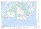
Maps showing Pateyville, Newfoundland and Labrador
Pateyville is a Unincorporated area located in Newfoundland and Labrador and has an elevation of 37 meters.
- Latitude: 51° 21' 24'' North (decimal: 51.3566666)
- Longitude: 55° 34' 20'' West (decimal: -55.5722222)
- Topography Feature Category: Unincorporated area
- Geographical Feature: Settlement
- Canadian Province/Territory: Newfoundland and Labrador
- Elevation: 37 meters
- Atlas of Canada Locator Map: Pateyville
- GPS Coordinate Locator Map: Pateyville Lat/Long
Pateyville NTS Map Sheets