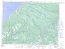
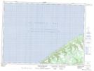
Maps showing Pauls Gulch, Newfoundland and Labrador
Pauls Gulch is a Valley located in Newfoundland and Labrador.
- Latitude: 48° 6' 58'' North (decimal: 48.1161111)
- Longitude: 59° 2' 20'' West (decimal: -59.0388888)
- Topography Feature Category: Valley
- Geographical Feature: Gulch
- Canadian Province/Territory: Newfoundland and Labrador
- Atlas of Canada Locator Map: Pauls Gulch
- GPS Coordinate Locator Map: Pauls Gulch Lat/Long
Pauls Gulch NTS Map Sheets