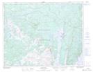
Maps showing Pennys Brook, Newfoundland and Labrador
Pennys Brook is a River located in Newfoundland and Labrador and has an elevation of 169 meters.
- Latitude: 50° 54' 35'' North (decimal: 50.9097222)
- Longitude: 56° 3' 21'' West (decimal: -56.0558333)
- Topography Feature Category: River
- Geographical Feature: Brook
- Canadian Province/Territory: Newfoundland and Labrador
- Elevation: 169 meters
- Atlas of Canada Locator Map: Pennys Brook
- GPS Coordinate Locator Map: Pennys Brook Lat/Long
Pennys Brook NTS Map Sheets