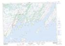
Maps showing Petit Forte Harbour, Newfoundland and Labrador
Petit Forte Harbour is a Bay located in Newfoundland and Labrador and has an elevation of 6 meters.
- Latitude: 47° 23' 48'' North (decimal: 47.3966666)
- Longitude: 54° 39' 34'' West (decimal: -54.6594444)
- Topography Feature Category: Bay
- Geographical Feature: Harbour
- Canadian Province/Territory: Newfoundland and Labrador
- Elevation: 6 meters
- Atlas of Canada Locator Map: Petit Forte Harbour
- GPS Coordinate Locator Map: Petit Forte Harbour Lat/Long
Petit Forte Harbour NTS Map Sheets