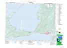
Maps showing Piccadilly, Newfoundland and Labrador
Piccadilly is a Unincorporated area located in Newfoundland and Labrador and has an elevation of 20 meters.
- Latitude: 48° 33' 9'' North (decimal: 48.5525000)
- Longitude: 58° 54' 51'' West (decimal: -58.9141666)
- Topography Feature Category: Unincorporated area
- Geographical Feature: Neighbourhood
- Canadian Province/Territory: Newfoundland and Labrador
- Elevation: 20 meters
- Atlas of Canada Locator Map: Piccadilly
- GPS Coordinate Locator Map: Piccadilly Lat/Long
Piccadilly NTS Map Sheets