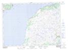
Maps showing Barasway de Plate, Newfoundland and Labrador
Barasway de Plate is a Lake located in Newfoundland and Labrador and has an elevation of 18 meters.
- Latitude: 47° 29' 17'' North (decimal: 47.4880555)
- Longitude: 55° 5' 7'' West (decimal: -55.0852777)
- Topography Feature Category: Lake
- Geographical Feature: Barasway
- Canadian Province/Territory: Newfoundland and Labrador
- Elevation: 18 meters
- Atlas of Canada Locator Map: Barasway de Plate
- GPS Coordinate Locator Map: Barasway de Plate Lat/Long
Barasway de Plate NTS Map Sheets