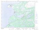
Maps showing Pointe Riche Peninsula, Newfoundland and Labrador
Pointe Riche Peninsula is a Cape located in Newfoundland and Labrador and has an elevation of 29 meters.
- Latitude: 50° 42' 18'' North (decimal: 50.7049999)
- Longitude: 57° 23' 19'' West (decimal: -57.3886111)
- Topography Feature Category: Cape
- Geographical Feature: Peninsula
- Canadian Province/Territory: Newfoundland and Labrador
- Elevation: 29 meters
- Atlas of Canada Locator Map: Pointe Riche Peninsula
- GPS Coordinate Locator Map: Pointe Riche Peninsula Lat/Long
Pointe Riche Peninsula NTS Map Sheets