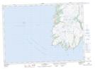
Maps showing Point Lance, St. Mary's-The Capes, Newfoundland and Labrador
Point Lance is a Town located in St. Mary's-The Capes, Newfoundland and Labrador and has an elevation of 33 meters.
- Latitude: 46° 49' 34'' North (decimal: 46.8261611)
- Longitude: 54° 5' 6'' West (decimal: -54.0850249)
- Topography Feature Category: Town
- Geographical Feature: Town
- Canadian Province/Territory: Newfoundland and Labrador
- Elevation: 33 meters
- Location: St. Mary's-The Capes
- Atlas of Canada Locator Map: Point Lance
- GPS Coordinate Locator Map: Point Lance Lat/Long
Point Lance NTS Map Sheets