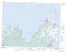
Maps showing Poor Shoal, Newfoundland and Labrador
Poor Shoal is a Shoal located in Newfoundland and Labrador.
- Latitude: 48° 31' 00'' North (decimal: 48.5166666)
- Longitude: 53° 0' 56'' West (decimal: -53.0155555)
- Topography Feature Category: Shoal
- Geographical Feature: Shoal
- Canadian Province/Territory: Newfoundland and Labrador
- Atlas of Canada Locator Map: Poor Shoal
- GPS Coordinate Locator Map: Poor Shoal Lat/Long
Poor Shoal NTS Map Sheets