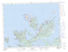
Maps showing Port Albert Peninsula, Newfoundland and Labrador
Port Albert Peninsula is a Cape located in Newfoundland and Labrador and has an elevation of 34 meters.
- Latitude: 49° 33' 3'' North (decimal: 49.5509369)
- Longitude: 54° 29' 55'' West (decimal: -54.4986563)
- Topography Feature Category: Cape
- Geographical Feature: Peninsula
- Canadian Province/Territory: Newfoundland and Labrador
- Elevation: 34 meters
- Atlas of Canada Locator Map: Port Albert Peninsula
- GPS Coordinate Locator Map: Port Albert Peninsula Lat/Long
Port Albert Peninsula NTS Map Sheets