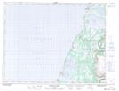
Maps showing Portland Hill, Newfoundland and Labrador
Portland Hill is a Mountain located in Newfoundland and Labrador and has an elevation of 78 meters.
- Latitude: 50° 8' 40'' North (decimal: 50.1444444)
- Longitude: 57° 37' 35'' West (decimal: -57.6263888)
- Topography Feature Category: Mountain
- Geographical Feature: Hill
- Canadian Province/Territory: Newfoundland and Labrador
- Elevation: 78 meters
- Atlas of Canada Locator Map: Portland Hill
- GPS Coordinate Locator Map: Portland Hill Lat/Long
Portland Hill NTS Map Sheets