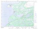
Maps showing Port Saunders, Newfoundland and Labrador
Port Saunders is a Town located in Newfoundland and Labrador and has an elevation of 35 meters.
- Latitude: 50° 39' 43'' North (decimal: 50.6620166)
- Longitude: 57° 15' 14'' West (decimal: -57.2538722)
- Topography Feature Category: Town
- Geographical Feature: Town
- Canadian Province/Territory: Newfoundland and Labrador
- Elevation: 35 meters
- Atlas of Canada Locator Map: Port Saunders
- GPS Coordinate Locator Map: Port Saunders Lat/Long
Port Saunders NTS Map Sheets