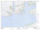
Maps showing Pushthrough, Newfoundland and Labrador
Pushthrough is a Channel located in Newfoundland and Labrador and has an elevation of 11 meters.
- Latitude: 47° 38' 35'' North (decimal: 47.6430555)
- Longitude: 56° 9' 33'' West (decimal: -56.1591666)
- Topography Feature Category: Channel
- Geographical Feature: Passage
- Canadian Province/Territory: Newfoundland and Labrador
- Elevation: 11 meters
- Atlas of Canada Locator Map: Pushthrough
- GPS Coordinate Locator Map: Pushthrough Lat/Long