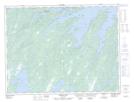
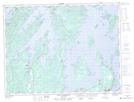
Maps showing Southern Lake, Lewisporte, Newfoundland and Labrador
Southern Lake is a Lake located in Lewisporte, Newfoundland and Labrador and has an elevation of 21 meters.
- Latitude: 49° 23' 1'' North (decimal: 49.3836110)
- Longitude: 55° 29' 40'' West (decimal: -55.4944443)
- Topography Feature Category: Lake
- Geographical Feature: Lake
- Canadian Province/Territory: Newfoundland and Labrador
- Elevation: 21 meters
- Location: Lewisporte
- Atlas of Canada Locator Map: Southern Lake
- GPS Coordinate Locator Map: Southern Lake Lat/Long
Southern Lake NTS Map Sheets