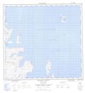
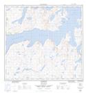
Maps showing Takkatat Inlet, Newfoundland and Labrador
Takkatat Inlet is a Bay located in Newfoundland and Labrador and has an elevation of 106 meters.
- Latitude: 58° 6' 24'' North (decimal: 58.1067298)
- Longitude: 62° 30' 51'' West (decimal: -62.5142124)
- Topography Feature Category: Bay
- Geographical Feature: Inlet
- Canadian Province/Territory: Newfoundland and Labrador
- Elevation: 106 meters
- Atlas of Canada Locator Map: Takkatat Inlet
- GPS Coordinate Locator Map: Takkatat Inlet Lat/Long
Takkatat Inlet NTS Map Sheets