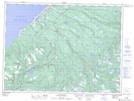
Maps showing Taylors Pond, Newfoundland and Labrador
Taylors Pond is a Lake located in Newfoundland and Labrador.
- Latitude: 48° 12' 0'' North (decimal: 48.2000000)
- Longitude: 58° 46' 57'' West (decimal: -58.7825000)
- Topography Feature Category: Lake
- Geographical Feature: Pond
- Canadian Province/Territory: Newfoundland and Labrador
- GPS Coordinate Locator Map: Taylors Pond Lat/Long
Taylors Pond NTS Map Sheets