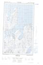
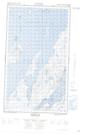
Maps showing Taylor's Table Cove, Newfoundland and Labrador
Taylor's Table Cove is a Bay located in Newfoundland and Labrador and has an elevation of 6 meters.
- Latitude: 55° 7' 15'' North (decimal: 55.1208569)
- Longitude: 59° 4' 42'' West (decimal: -59.0782481)
- Topography Feature Category: Bay
- Geographical Feature: Cove
- Canadian Province/Territory: Newfoundland and Labrador
- Elevation: 6 meters
- Atlas of Canada Locator Map: Taylor's Table Cove
- GPS Coordinate Locator Map: Taylor's Table Cove Lat/Long
Taylor's Table Cove NTS Map Sheets