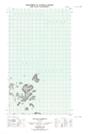
Maps showing Teapot Island, Newfoundland and Labrador
Teapot Island is a Island located in Newfoundland and Labrador.
- Latitude: 54° 34' 25'' North (decimal: 54.5735179)
- Longitude: 57° 12' 5'' West (decimal: -57.2012781)
- Topography Feature Category: Island
- Geographical Feature: Island
- Canadian Province/Territory: Newfoundland and Labrador
- Atlas of Canada Locator Map: Teapot Island
- GPS Coordinate Locator Map: Teapot Island Lat/Long
Teapot Island NTS Map Sheets