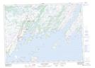
Maps showing Cape Roger Harbour, Newfoundland and Labrador
Cape Roger Harbour is a Bay located in Newfoundland and Labrador and has an elevation of 27 meters.
- Latitude: 47° 22' 59'' North (decimal: 47.3830555)
- Longitude: 54° 44' 22'' West (decimal: -54.7394444)
- Topography Feature Category: Bay
- Geographical Feature: Harbour
- Canadian Province/Territory: Newfoundland and Labrador
- Elevation: 27 meters
- Atlas of Canada Locator Map: Cape Roger Harbour
- GPS Coordinate Locator Map: Cape Roger Harbour Lat/Long
Cape Roger Harbour NTS Map Sheets