Maps showing Shoal Tickle, Newfoundland and Labrador
Shoal Tickle is a Channel located in Newfoundland and Labrador and has an elevation of 5 meters.
- Latitude: 49° 38' 40'' North (decimal: 49.6444444)
- Longitude: 54° 46' 12'' West (decimal: -54.7699999)
- Topography Feature Category: Channel
- Geographical Feature: Tickle
- Canadian Province/Territory: Newfoundland and Labrador
- Elevation: 5 meters
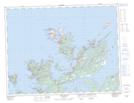
- Atlas of Canada Locator Map: Shoal Tickle
- GPS Coordinate Locator Map: Shoal Tickle Lat/Long
Shoal Tickle NTS Map Sheets