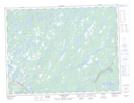
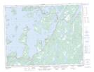
Maps showing Rocky Pond, Newfoundland and Labrador
Rocky Pond is a Lake located in Newfoundland and Labrador and has an elevation of 49 meters.
- Latitude: 49° 16' 33'' North (decimal: 49.2757971)
- Longitude: 54° 39' 51'' West (decimal: -54.6641800)
- Topography Feature Category: Lake
- Geographical Feature: Pond
- Canadian Province/Territory: Newfoundland and Labrador
- Elevation: 49 meters
- Atlas of Canada Locator Map: Rocky Pond
- GPS Coordinate Locator Map: Rocky Pond Lat/Long
Rocky Pond NTS Map Sheets