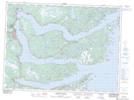
Maps showing Trout Pond, Newfoundland and Labrador
Trout Pond is a Lake located in Newfoundland and Labrador.
- Latitude: 48° 3' 25'' North (decimal: 48.0569444)
- Longitude: 53° 44' 7'' West (decimal: -53.7352777)
- Topography Feature Category: Lake
- Geographical Feature: Pond
- Canadian Province/Territory: Newfoundland and Labrador
- GPS Coordinate Locator Map: Trout Pond Lat/Long
Trout Pond NTS Map Sheets