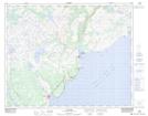
Maps showing Skipper Neds Brook, Newfoundland and Labrador
Skipper Neds Brook is a River located in Newfoundland and Labrador and has an elevation of 31 meters.
- Latitude: 51° 40' 25'' North (decimal: 51.6736111)
- Longitude: 56° 32' 39'' West (decimal: -56.5441666)
- Topography Feature Category: River
- Geographical Feature: Brook
- Canadian Province/Territory: Newfoundland and Labrador
- Elevation: 31 meters
- Atlas of Canada Locator Map: Skipper Neds Brook
- GPS Coordinate Locator Map: Skipper Neds Brook Lat/Long
Skipper Neds Brook NTS Map Sheets