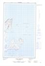
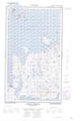
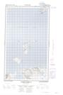
Maps showing Sloop Cove, Newfoundland and Labrador
Sloop Cove is a Bay located in Newfoundland and Labrador and has an elevation of 35 meters.
- Latitude: 54° 52' 4'' North (decimal: 54.8679158)
- Longitude: 57° 59' 11'' West (decimal: -57.9863979)
- Topography Feature Category: Bay
- Geographical Feature: Cove
- Canadian Province/Territory: Newfoundland and Labrador
- Elevation: 35 meters
- Atlas of Canada Locator Map: Sloop Cove
- GPS Coordinate Locator Map: Sloop Cove Lat/Long
Sloop Cove NTS Map Sheets