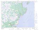
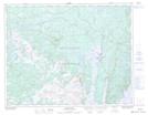
Maps showing Small Seal Cove Pond, Newfoundland and Labrador
Small Seal Cove Pond is a Lake located in Newfoundland and Labrador and has an elevation of 11 meters.
- Latitude: 50° 45' 4'' North (decimal: 50.7511111)
- Longitude: 56° 7' 32'' West (decimal: -56.1255555)
- Topography Feature Category: Lake
- Geographical Feature: Pond
- Canadian Province/Territory: Newfoundland and Labrador
- Elevation: 11 meters
- Atlas of Canada Locator Map: Small Seal Cove Pond
- GPS Coordinate Locator Map: Small Seal Cove Pond Lat/Long
Small Seal Cove Pond NTS Map Sheets