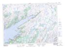
Maps showing Smock Island, Newfoundland and Labrador
Smock Island is a Island located in Newfoundland and Labrador.
- Latitude: 47° 36' 3'' North (decimal: 47.6008333)
- Longitude: 54° 59' 35'' West (decimal: -54.9930555)
- Topography Feature Category: Island
- Geographical Feature: Island
- Canadian Province/Territory: Newfoundland and Labrador
- GPS Coordinate Locator Map: Smock Island Lat/Long
Smock Island NTS Map Sheets