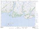
Maps showing Round Island, Newfoundland and Labrador
Round Island is a Island located in Newfoundland and Labrador and has an elevation of 10 meters.
- Latitude: 47° 38' 4'' North (decimal: 47.6344444)
- Longitude: 57° 22' 2'' West (decimal: -57.3672222)
- Topography Feature Category: Island
- Geographical Feature: Island
- Canadian Province/Territory: Newfoundland and Labrador
- Elevation: 10 meters
- Atlas of Canada Locator Map: Round Island
- GPS Coordinate Locator Map: Round Island Lat/Long