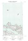
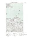
Maps showing Round Island Bank, Newfoundland and Labrador
Round Island Bank is a Shoal located in Newfoundland and Labrador.
- Latitude: 53° 38' 0'' North (decimal: 53.6333743)
- Longitude: 56° 0' 12'' West (decimal: -56.0032109)
- Topography Feature Category: Shoal
- Geographical Feature: Bank
- Canadian Province/Territory: Newfoundland and Labrador
- Atlas of Canada Locator Map: Round Island Bank
- GPS Coordinate Locator Map: Round Island Bank Lat/Long
Round Island Bank NTS Map Sheets