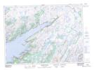
Maps showing Grandys Pond, Newfoundland and Labrador
Grandys Pond is a Lake located in Newfoundland and Labrador and has an elevation of 165 meters.
- Latitude: 47° 35' 33'' North (decimal: 47.5925000)
- Longitude: 54° 43' 11'' West (decimal: -54.7197222)
- Topography Feature Category: Lake
- Geographical Feature: Pond
- Canadian Province/Territory: Newfoundland and Labrador
- Elevation: 165 meters
- Atlas of Canada Locator Map: Grandys Pond
- GPS Coordinate Locator Map: Grandys Pond Lat/Long
Grandys Pond NTS Map Sheets