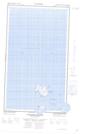
Maps showing Grapple Island, Newfoundland and Labrador
Grapple Island is a Island located in Newfoundland and Labrador.
- Latitude: 55° 15' 00'' North (decimal: 55.2499999)
- Longitude: 59° 17' 56'' West (decimal: -59.2988888)
- Topography Feature Category: Island
- Geographical Feature: Island
- Canadian Province/Territory: Newfoundland and Labrador
- GPS Coordinate Locator Map: Grapple Island Lat/Long
Grapple Island NTS Map Sheets