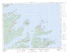
Maps showing Triton-Jim's Cove-Card's Harbour, Newfoundland and Labrador
Triton-Jim's Cove-Card's Harbour is a Other municipal/district area - miscellaneous located in Newfoundland and Labrador.
- Latitude: 49° 31' 00'' North (decimal: 49.5166666)
- Longitude: 55° 36' 57'' West (decimal: -55.6158333)
- Topography Feature Category: Other municipal/district area - miscellaneous
- Geographical Feature: Rural District
- Canadian Province/Territory: Newfoundland and Labrador
- GPS Coordinate Locator Map: Triton-Jim's Cove-Card's Harbour Lat/Long
Triton-Jim's Cove-Card's Harbour NTS Map Sheets