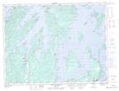
Maps showing Two Mile Brook, Newfoundland and Labrador
Two Mile Brook is a River located in Newfoundland and Labrador and has an elevation of 62 meters.
- Latitude: 49° 17' 45'' North (decimal: 49.2958333)
- Longitude: 55° 23' 18'' West (decimal: -55.3883333)
- Topography Feature Category: River
- Geographical Feature: Brook
- Canadian Province/Territory: Newfoundland and Labrador
- Elevation: 62 meters
- Atlas of Canada Locator Map: Two Mile Brook
- GPS Coordinate Locator Map: Two Mile Brook Lat/Long
Two Mile Brook NTS Map Sheets