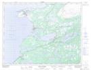
Maps showing Two Tree Hill, Newfoundland and Labrador
Two Tree Hill is a Mountain located in Newfoundland and Labrador and has an elevation of 27 meters.
- Latitude: 50° 38' 56'' North (decimal: 50.6488888)
- Longitude: 57° 17' 49'' West (decimal: -57.2969444)
- Topography Feature Category: Mountain
- Geographical Feature: Hill
- Canadian Province/Territory: Newfoundland and Labrador
- Elevation: 27 meters
- Atlas of Canada Locator Map: Two Tree Hill
- GPS Coordinate Locator Map: Two Tree Hill Lat/Long
Two Tree Hill NTS Map Sheets