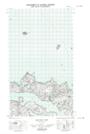
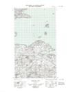
Maps showing South Black Rock, Newfoundland and Labrador
South Black Rock is a Shoal located in Newfoundland and Labrador.
- Latitude: 53° 36' 24'' North (decimal: 53.6067760)
- Longitude: 56° 1' 54'' West (decimal: -56.0316074)
- Topography Feature Category: Shoal
- Geographical Feature: Rock
- Canadian Province/Territory: Newfoundland and Labrador
- Atlas of Canada Locator Map: South Black Rock
- GPS Coordinate Locator Map: South Black Rock Lat/Long
South Black Rock NTS Map Sheets