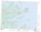
Maps showing Southern Head, Newfoundland and Labrador
Southern Head is a Cape located in Newfoundland and Labrador and has an elevation of 4 meters.
- Latitude: 48° 41' 28'' North (decimal: 48.6911111)
- Longitude: 53° 37' 17'' West (decimal: -53.6213888)
- Topography Feature Category: Cape
- Geographical Feature: Head
- Canadian Province/Territory: Newfoundland and Labrador
- Elevation: 4 meters
- Atlas of Canada Locator Map: Southern Head
- GPS Coordinate Locator Map: Southern Head Lat/Long