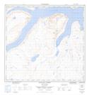
Maps showing Southwest Arm, Newfoundland and Labrador
Southwest Arm is a Bay located in Newfoundland and Labrador and has an elevation of 7 meters.
- Latitude: 58° 28' 33'' North (decimal: 58.4757454)
- Longitude: 63° 29' 52'' West (decimal: -63.4978720)
- Topography Feature Category: Bay
- Geographical Feature: Arm
- Canadian Province/Territory: Newfoundland and Labrador
- Elevation: 7 meters
- Atlas of Canada Locator Map: Southwest Arm
- GPS Coordinate Locator Map: Southwest Arm Lat/Long
Southwest Arm NTS Map Sheets