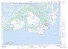
Maps showing St. Anthony, Newfoundland and Labrador
St. Anthony is a Town located in Newfoundland and Labrador and has an elevation of 27 meters.
- Latitude: 51° 22' 30'' North (decimal: 51.3749361)
- Longitude: 55° 36' 59'' West (decimal: -55.6164055)
- Topography Feature Category: Town
- Geographical Feature: Town
- Canadian Province/Territory: Newfoundland and Labrador
- Elevation: 27 meters
- Atlas of Canada Locator Map: St. Anthony
- GPS Coordinate Locator Map: St. Anthony Lat/Long
St. Anthony NTS Map Sheets