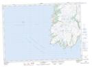
Maps showing St. Bride's, Newfoundland and Labrador
St. Bride's is a Town located in Newfoundland and Labrador and has an elevation of 17 meters.
- Latitude: 46° 55' 15'' North (decimal: 46.9208333)
- Longitude: 54° 10' 16'' West (decimal: -54.1711111)
- Topography Feature Category: Town
- Geographical Feature: Town
- Canadian Province/Territory: Newfoundland and Labrador
- Elevation: 17 meters
- Atlas of Canada Locator Map: St. Bride's
- GPS Coordinate Locator Map: St. Bride's Lat/Long
St. Bride's NTS Map Sheets