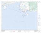
Maps showing Pointe Saint-Charles, Eagle River, Newfoundland and Labrador
Pointe Saint-Charles is a Cape located in Eagle River, Newfoundland and Labrador and has an elevation of 18 meters.
- Latitude: 51° 25' 0'' North (decimal: 51.4167177)
- Longitude: 57° 5' 57'' West (decimal: -57.0990582)
- Topography Feature Category: Cape
- Geographical Feature: Pointe
- Canadian Province/Territory: Newfoundland and Labrador
- Elevation: 18 meters
- Location: Eagle River
- Atlas of Canada Locator Map: Pointe Saint-Charles
- GPS Coordinate Locator Map: Pointe Saint-Charles Lat/Long
Pointe Saint-Charles NTS Map Sheets