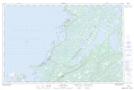
Maps showing Ste. Genevieve Bay, Newfoundland and Labrador
Ste. Genevieve Bay is a Bay located in Newfoundland and Labrador and has an elevation of 0 meters.
- Latitude: 51° 8' 39'' North (decimal: 51.1441666)
- Longitude: 56° 50' 16'' West (decimal: -56.8377777)
- Topography Feature Category: Bay
- Geographical Feature: Bay
- Canadian Province/Territory: Newfoundland and Labrador
- Elevation: 0 meters
- Atlas of Canada Locator Map: Ste. Genevieve Bay
- GPS Coordinate Locator Map: Ste. Genevieve Bay Lat/Long
Ste. Genevieve Bay NTS Map Sheets