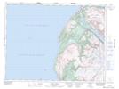
Maps showing Mount St. Gregory, Newfoundland and Labrador
Mount St. Gregory is a Mountain located in Newfoundland and Labrador and has an elevation of 591 meters.
- Latitude: 49° 19' 19'' North (decimal: 49.3219444)
- Longitude: 58° 12' 27'' West (decimal: -58.2074999)
- Topography Feature Category: Mountain
- Geographical Feature: Mount
- Canadian Province/Territory: Newfoundland and Labrador
- Elevation: 591 meters
- Atlas of Canada Locator Map: Mount St. Gregory
- GPS Coordinate Locator Map: Mount St. Gregory Lat/Long
Mount St. Gregory NTS Map Sheets