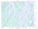
Maps showing St. John's Harbour, Newfoundland and Labrador
St. John's Harbour is a Bay located in Newfoundland and Labrador and has an elevation of 16 meters.
- Latitude: 49° 18' 46'' North (decimal: 49.3127777)
- Longitude: 55° 8' 23'' West (decimal: -55.1397222)
- Topography Feature Category: Bay
- Geographical Feature: Harbour
- Canadian Province/Territory: Newfoundland and Labrador
- Elevation: 16 meters
- Atlas of Canada Locator Map: St. John's Harbour
- GPS Coordinate Locator Map: St. John's Harbour Lat/Long
St. John's Harbour NTS Map Sheets