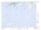
Maps showing St. John's Head, Newfoundland and Labrador
St. John's Head is a Cape located in Newfoundland and Labrador and has an elevation of 8 meters.
- Latitude: 47° 25' 42'' North (decimal: 47.4283333)
- Longitude: 55° 40' 10'' West (decimal: -55.6694443)
- Topography Feature Category: Cape
- Geographical Feature: Head
- Canadian Province/Territory: Newfoundland and Labrador
- Elevation: 8 meters
- Atlas of Canada Locator Map: St. John's Head
- GPS Coordinate Locator Map: St. John's Head Lat/Long
St. John's Head NTS Map Sheets