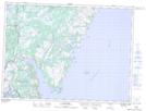
Maps showing St. Jones Islands, Bellevue, Newfoundland and Labrador
St. Jones Islands is a Island located in Bellevue, Newfoundland and Labrador and has an elevation of 0 meters.
- Latitude: 47° 55' 13'' North (decimal: 47.9202777)
- Longitude: 53° 40' 18'' West (decimal: -53.6716666)
- Topography Feature Category: Island
- Geographical Feature: Islands
- Canadian Province/Territory: Newfoundland and Labrador
- Elevation: 0 meters
- Location: Bellevue
- Atlas of Canada Locator Map: St. Jones Islands
- GPS Coordinate Locator Map: St. Jones Islands Lat/Long
St. Jones Islands NTS Map Sheets