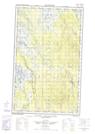
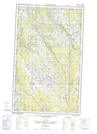
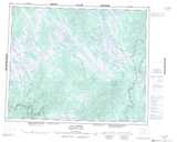
Maps showing St. Patrick Bay, Newfoundland and Labrador
St. Patrick Bay is a Bay located in Newfoundland and Labrador and has an elevation of 540 meters.
- Latitude: 52° 28' 00'' North (decimal: 52.4666666)
- Longitude: 65° 45' 58'' West (decimal: -65.7661111)
- Topography Feature Category: Bay
- Geographical Feature: Bay
- Canadian Province/Territory: Newfoundland and Labrador
- Elevation: 540 meters
- Atlas of Canada Locator Map: St. Patrick Bay
- GPS Coordinate Locator Map: St. Patrick Bay Lat/Long
St. Patrick Bay NTS Map Sheets