Maps showing St. Veronica's, Newfoundland and Labrador
St. Veronica's is a Unincorporated area located in Newfoundland and Labrador and has an elevation of 50 meters.
- Latitude: 47° 57' 6'' North (decimal: 47.9516666)
- Longitude: 55° 47' 5'' West (decimal: -55.7847222)
- Topography Feature Category: Unincorporated area
- Geographical Feature: Neighbourhood
- Canadian Province/Territory: Newfoundland and Labrador
- Elevation: 50 meters
- Atlas of Canada Locator Map: St. Veronica's
- GPS Coordinate Locator Map: St. Veronica's Lat/Long
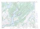
St. Veronica's NTS Map Sheets