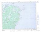
Maps showing Verte Bay, Newfoundland and Labrador
Verte Bay is a Bay located in Newfoundland and Labrador and has an elevation of 16 meters.
- Latitude: 51° 2' 45'' North (decimal: 51.0458333)
- Longitude: 55° 48' 35'' West (decimal: -55.8097222)
- Topography Feature Category: Bay
- Geographical Feature: Bay
- Canadian Province/Territory: Newfoundland and Labrador
- Elevation: 16 meters
- Atlas of Canada Locator Map: Verte Bay
- GPS Coordinate Locator Map: Verte Bay Lat/Long
Verte Bay NTS Map Sheets