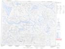
Maps showing Lac Vieux-Pont, Newfoundland and Labrador
Lac Vieux-Pont is a Lake located in Newfoundland and Labrador and has an elevation of 596 meters.
- Latitude: 51° 53' 00'' North (decimal: 51.8833333)
- Longitude: 64° 46' 58'' West (decimal: -64.7827777)
- Topography Feature Category: Lake
- Geographical Feature: Lac
- Canadian Province/Territory: Newfoundland and Labrador
- Elevation: 596 meters
- Atlas of Canada Locator Map: Lac Vieux-Pont
- GPS Coordinate Locator Map: Lac Vieux-Pont Lat/Long
Lac Vieux-Pont NTS Map Sheets