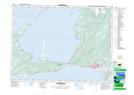
Maps showing West Bay Centre, Newfoundland and Labrador
West Bay Centre is a Unincorporated area located in Newfoundland and Labrador and has an elevation of 11 meters.
- Latitude: 48° 36' 10'' North (decimal: 48.6027777)
- Longitude: 58° 57' 26'' West (decimal: -58.9572222)
- Topography Feature Category: Unincorporated area
- Geographical Feature: Neighbourhood
- Canadian Province/Territory: Newfoundland and Labrador
- Elevation: 11 meters
- Atlas of Canada Locator Map: West Bay Centre
- GPS Coordinate Locator Map: West Bay Centre Lat/Long
West Bay Centre NTS Map Sheets