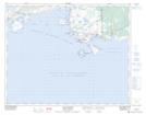
Maps showing Pointe St. Charles, Newfoundland and Labrador
Pointe St. Charles is a Cape located in Newfoundland and Labrador.
- Latitude: 51° 25' 00'' North (decimal: 51.4166666)
- Longitude: 57° 5' 57'' West (decimal: -57.0991666)
- Topography Feature Category: Cape
- Geographical Feature: Pointe
- Canadian Province/Territory: Newfoundland and Labrador
- GPS Coordinate Locator Map: Pointe St. Charles Lat/Long
Pointe St. Charles NTS Map Sheets